
How to Conduct a Basic Sludge Survey
By: Andrew Ambrocichuk and Rafael Machado
Introduction
Conducting a basic sludge survey will allow you to estimate the sludge / sediment volume in a wastewater lagoon or storm water retention pond. This will aid in determining if lagoon maintenance is required or gauge the preliminary success of a bioaugmentation product. It is also a great way to monitor your lagoon's performance year-to-year.
A basic sludge survey is a way to determine if you require a more thorough, comprehensive third party sludge survey. Keep in mind that a basic sludge survey can be up to 50% less accurate than a Comprehensive Sludge Survey; however, by performing your own basic sludge survey it will give you a good idea of you lagoon and whether you should hire professionals. If you want more in depth knowledge about conducting a basic sludge survey refer to this article.
What You’ll Need
Equipment
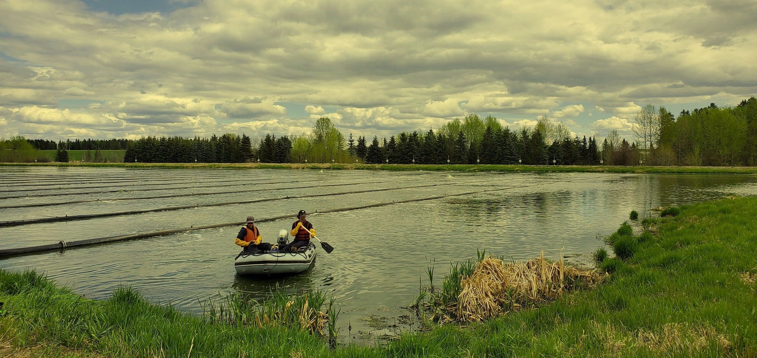
Two people with standard personal protective equipment and experience working on water
A small work boat with an outboard motor (flat bottom or inflatable boats are best for wastewater due to their stability)
Paddles and a marine safety kit
A small anchor
PFDs for each person working on or near the lagoon
Life ring and throw bag with 50ft of floating rope
Emergency rescue and egress plan
Survey Equipment
Infrared sludge interface detector (Sludge Gun or similar)
Handheld GPS unit capable of displaying location or wooden stakes for laying out shore grid
Pen and notepad
Before you get Started
Remember to inspect your PPE, boat and motor to ensure everything is in working order and safe to use.
Check the weather and make sure the winds are forecasted to remain below 20kph (12.5 mph) and that there is no risk of thunderstorms.
Bring enough food and water to the lagoon with you to last as long as you need to complete your survey.
Cover up or wear sunscreen when appropriate.
Ensure you follow all local, provincial and federal safety regulations.
Conducting a Basic Sludge Survey
1. On-shore Preparation
Using your pen and paper draw out a rough map of the lagoon cell you are surveying.
You should aim to take sludge measurements at 20-30 points. Lay out a grid on your sketched lagoon cell where the intersection of each line represents one sludge measurement location. It should look something like this:

The black lines over cell 1 represent a survey grid of 25 points.
You can either use evenly spaced ground stakes to use as reference when you’re on the lagoon or a basic GPS that displays and records your position to roughly space out your grid.
Label the intersection of each line with a number. Alternatively, you can use numbers for horizontal lines and letters for vertical lines, so that you’ll have points named as 1A.
Load the boat with all equipment and PPE you will need, including the metered survey rod, sludge gun, GPS, field notes and pen.
2. Performing measurements
At each intersection, perform both liner and sludge measurements.
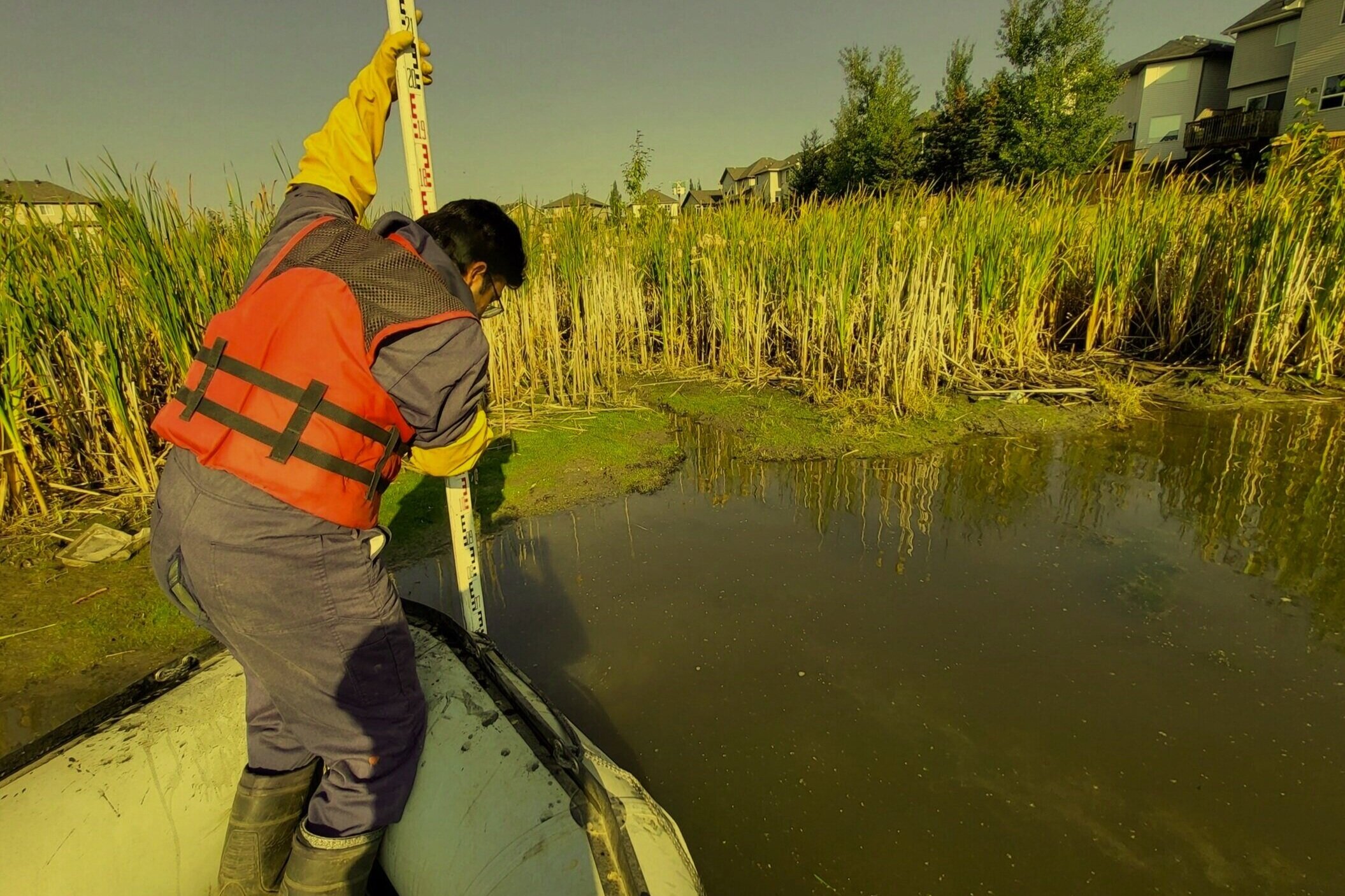
Liner measurement: Using the metered survey rod, push down through the sludge blanket while keeping the rod vertical. Once you hit the liner, read the depth and write down the value in the field notes at the appropriate labelled grid intersection.
Sludge measurement: deploy the infrared sludge interface detector (Sludge gun) with interval markings and write down the depth value in the field notes at the labelled grid intersection.
In your field notes, write down any noticeable findings such as odors, presence of animals, presence of synthetics/rags, shoreline vegetation, bank erosion, etc.
PRO TIP: Sludge is far less dense than a clay or HDPE liner; little effort is usually required to push through the sludge blanket and when you reach the liner, the effort to push the rod will increase a lot and this is when you know you've reached the liner. Also, if you have record drawings of your lagoon, those can act as a guide so you know roughly what depth you should expect to find the liner.

Calculations
Based on the your measurements, for each intersection you will have the following data:
Top of sludge depth
Liner depth
From the measurements above, calculate the following numbers:
Sludge thickness (Liner depth – Top of sludge depth)
Average sludge depth
Average liner depth
Average sludge thickness
If the area of the cell is known, you can roughly calculate the sludge volume by multiplying the cell area by the average sludge thickness.

Analyze Your Results
Based on the information you calculated from the measured data and considering your lagoon’s designed optimal operating efficiency, you can evaluate if you need a comprehensive third party sludge survey. If your lagoon is running within the optimal sludge efficiency, store your data and perform a basic sludge survey annually to monitor sludge volumes. However, keep in mind water elevation may vary and must be taken into consideration when comparing basic sludge surveys year-to-year.
If your lagoon is not within the optimal operating range or if you have questions regarding your lagoon’s performance, it is advised you complete a comprehensive sludge survey performed by a third party hydrographic surveying company. This survey will provide you with precise sludge measurements that are required to accurately estimate dredging costs or lagoon management projects. Also included in a comprehensive sludge survey is a third-party, expert evaluation of your lagoon’s performance and information to help you accurately budget for lagoon projects.
Hydrasurvey is a third-party, hydrographic surveying company who completes comprehensive sludge and sediment surveys in wastewater lagoons across Canada and The United States. We have offices in Edmonton, Alberta and Toronto, Ontario and would be happy to answer any questions you have regarding your wastewater project.
Contact Hydrasurvey if you have any questions regarding your lagoon’s performance or if you are planning a lagoon management project.