
Dredge and Bioaugmentation Monitoring
Smarter Dredging and Bioaugmentation Starts with the Best Data
Precise sludge mapping for targeted, cost-effective results
At Hydrasurvey, we help you:
Map sludge with precision
Make data-backed decisions
Maximize efficiency
Tight budget? No problem.
Targeted monitoring ensures every dollar goes toward high-impact zones.
What This Service Includes
Pre-Dredging / Treatment Surveys
Understand present sludge levels to set benchmarks and budgets
Mid-Project Checks
Validate progress, adjust plans or budgets as needed
Post-Treatment Surveys
Confirm results and measure amount removed / treatment success
Visual Tools for Deeper Insight
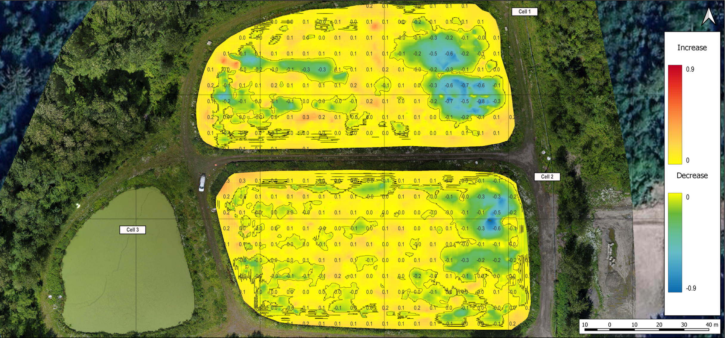
Sludge Blanket Change Maps
These maps provide a clear visual representation of sludge accumulation in your wastewater treatment system.
Used before and after dredging, they highlight how much sludge was removed and where the buildup remains.
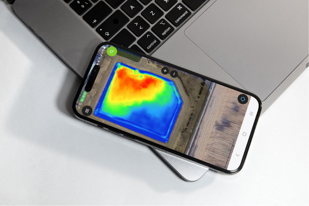
Sludge Maps Presented on a Field App
These maps allow contractors to pinpoint key areas of concern and increase dredging efficiency while on-site.
What’s Included in Your Survey
-

Sludge Blanket Thickness Maps
Sludge blanket thickness maps provide a clear visual of where your sludge buildup occurs and how it’s distributed across the bottom of your lagoon or pond. These maps are an excellent visual when dredging, they display what progress has been completed.
-

3D Sludge and Sediment Maps
3D sludge / sediment maps are provided to display your lagoon or ponds sludge characteristics. They can be provided to contractors for improved efficiency.
-

GNSS Liner Maps
We manually measure the liner using a GNSS mounted survey rod to provide you with liner elevation maps. This also increases the accuracy when quantifying sludge and sediment volumes.
-

Sludge & Sediment Samples
We collect and test, at an accredited lab, sludge or sediment samples to determine composition. Composition is required to calculate sludge / sediment volume and provide you with dredging disposal options.
-

RTK GNSS Positioning
Using RTK GNSS positioning to map your sludge or sediment blanket provides you to the most accurate data.
-
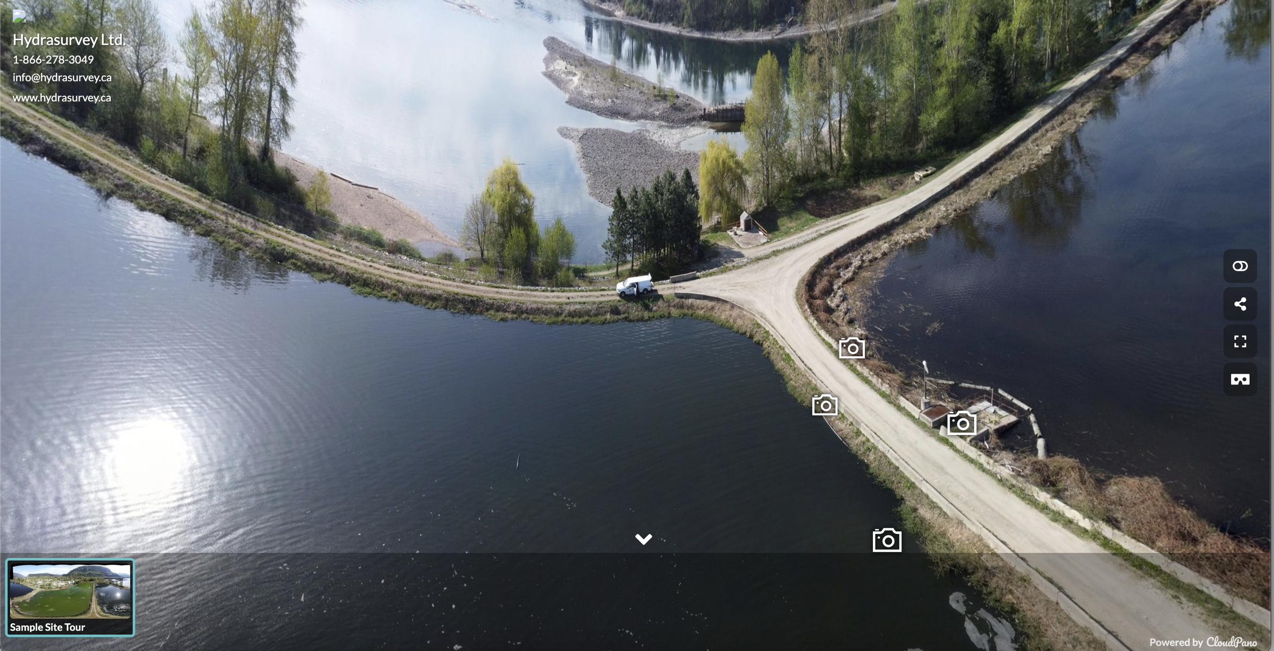
Virtual Site Tour
Our site tours include an aerial map or panoramic photos captured during the survey, with inset images highlighting key findings. This helps identify mechanical or infrastructure issues that might be missed from a single vantage point.