Sludge & Sediment Surveys
Sludge Surveys Reduce Maintenance Costs
Dredging and Bioaugmentation costs more when you haven’t measured your sludge or sediment.
Planning to dredge or use bioaugmentation without knowing how much sludge or sediment is present leads to increased costs, project delays, and extra work.
Without a survey, you will pay more for removal and have no way to verify if your treatment is effective.
Get it right the first time!

Our Surveys Give You Clear Data To:
Save money on dredging & bioaugmentation
Plan and budget effectively
Ensure accurate contractor performance
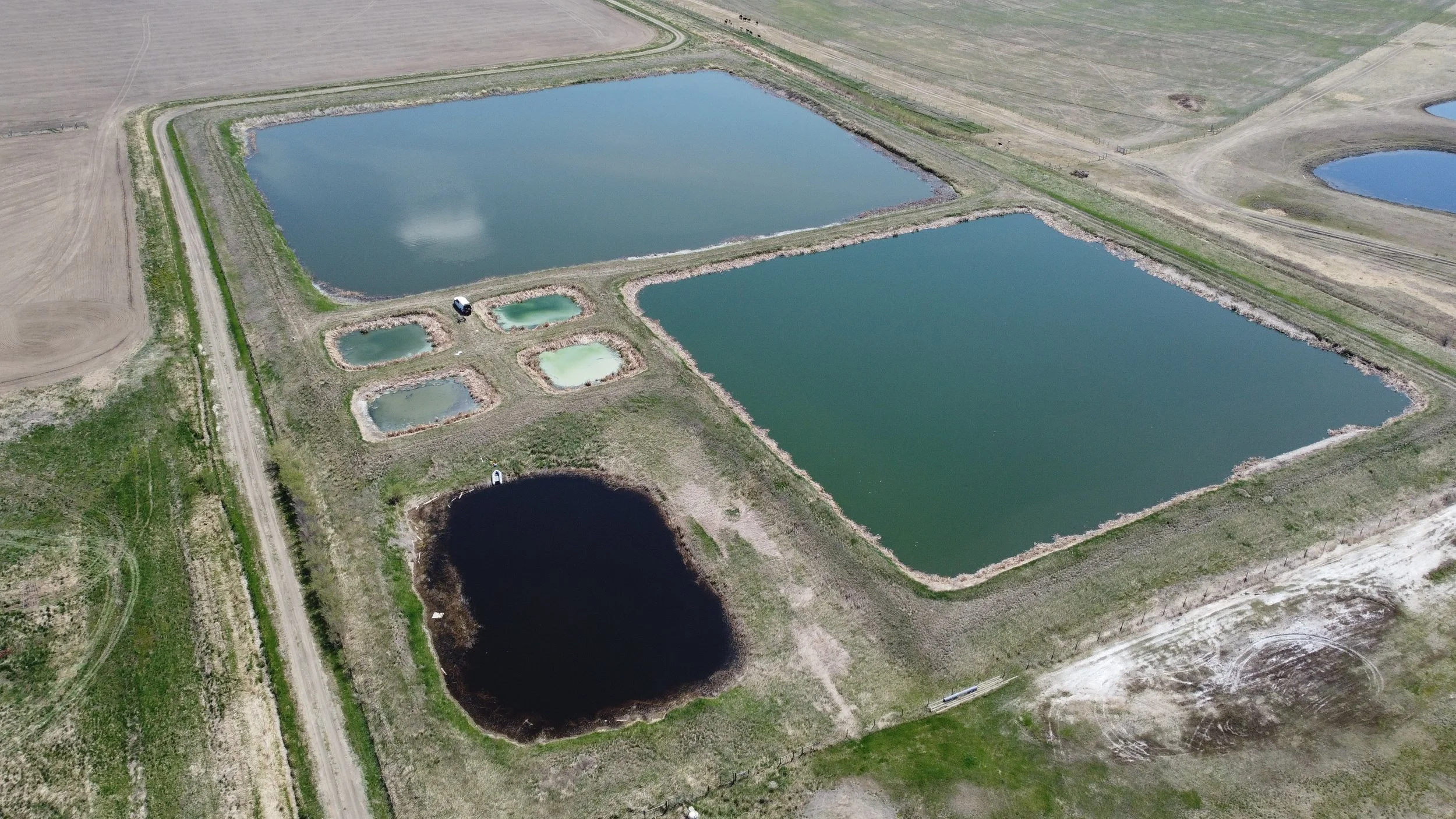
Sediment Surveys
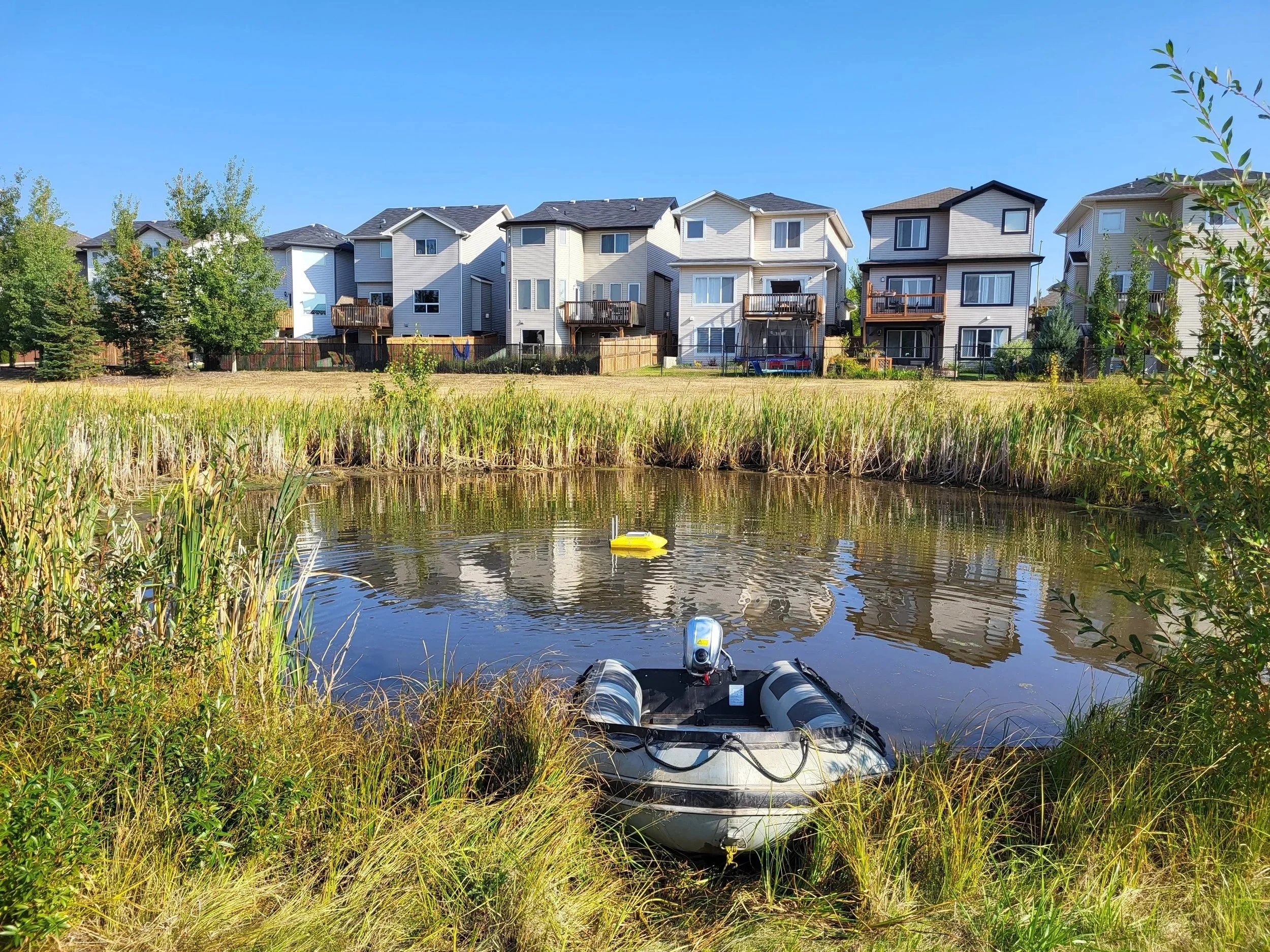
Stormwater retention ponds manage excess groundwater and runoff in cities, crucial for flood control.
Our hydrographic surveys provide insights into each pond's storage capacity, sediment volume, composition, and infrastructure unknowns.
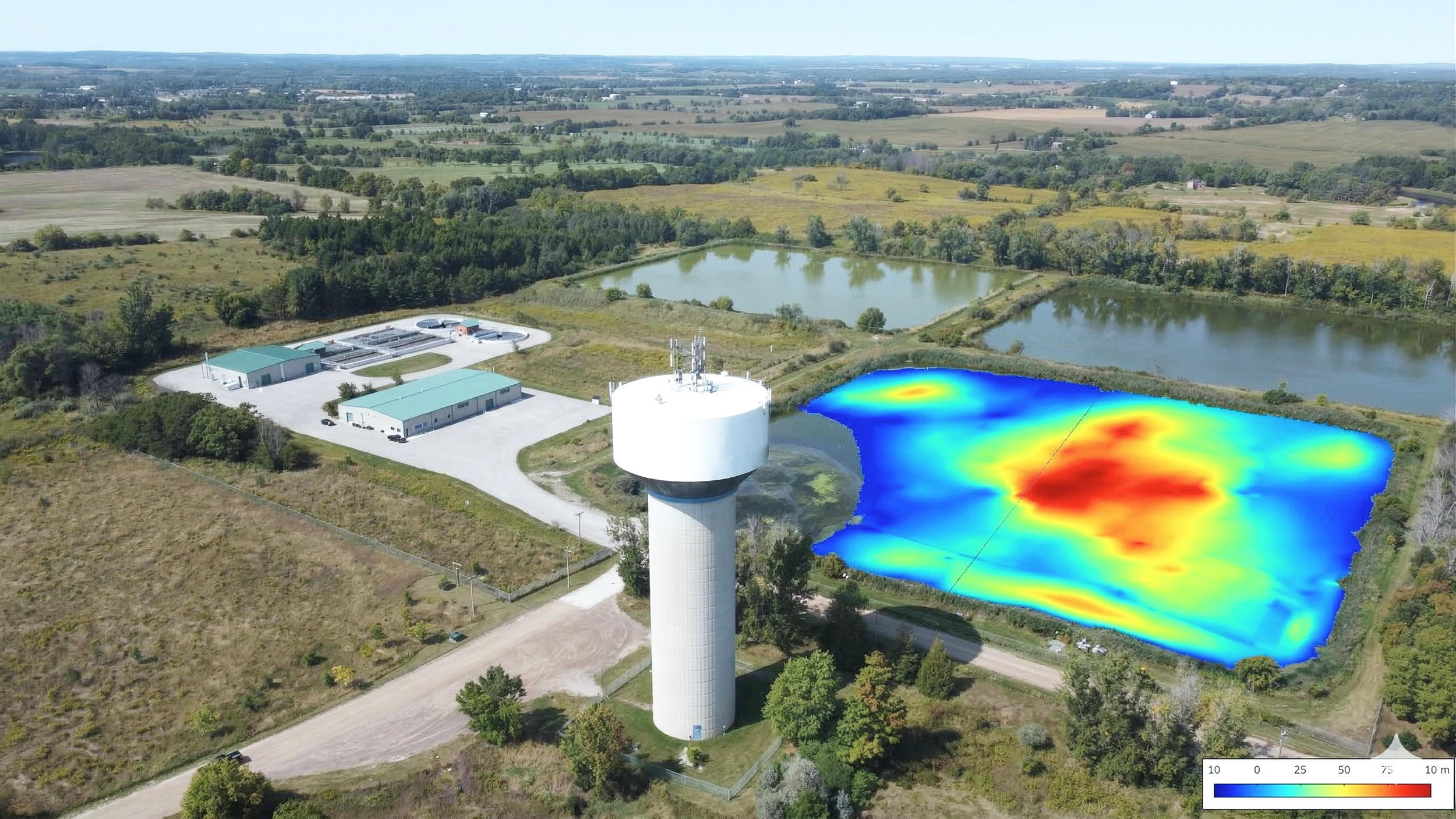
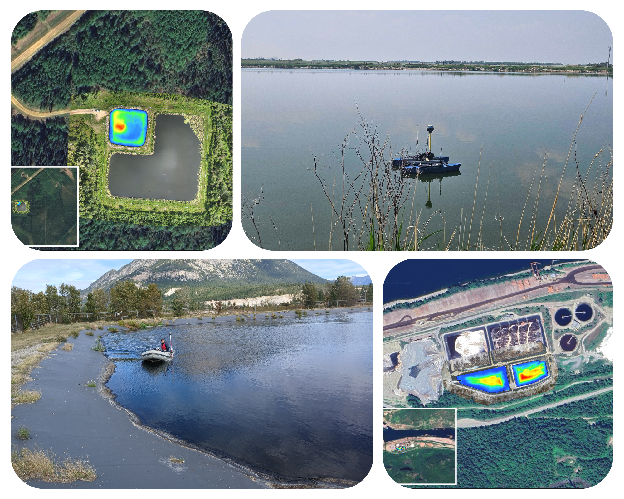
Reports include 3D sediment maps overlaid on drone images for easy planning and presentation.
Optimize Stormwater or Raw Water Ponds with Bathymetry
What’s Included in Your Survey
-

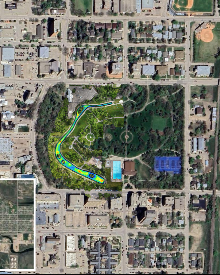
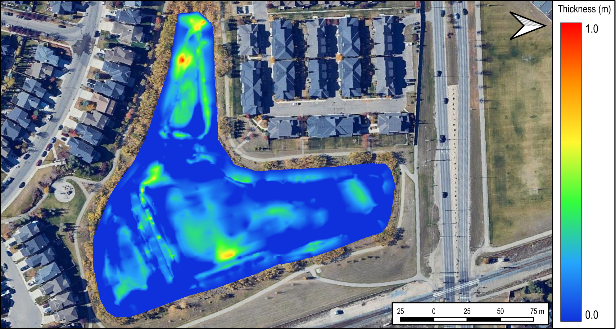
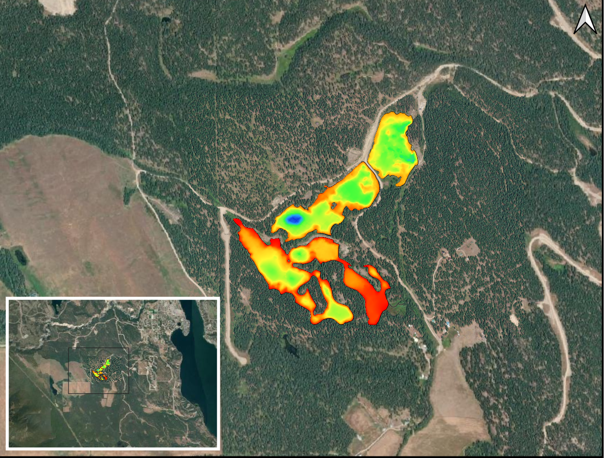
Sludge Blanket Thickness Maps
Sludge blanket thickness maps provide a clear visual of where your sludge buildup occurs and how it’s distributed across the bottom of your lagoon or pond. These maps are an excellent visual when dredging, they display what progress has been completed.
-

3D Sludge and Sediment Maps
3D sludge / sediment maps are provided to display your lagoon or ponds sludge characteristics. They can be provided to contractors for improved efficiency.
-

GNSS Liner Maps
We manually measure the liner using a GNSS mounted survey rod to provide you with liner elevation maps. This also increases the accuracy when quantifying sludge and sediment volumes.
-

Sludge & Sediment Samples
We collect and test, at an accredited lab, sludge or sediment samples to determine composition. Composition is required to calculate sludge / sediment volume and provide you with dredging disposal options.
-

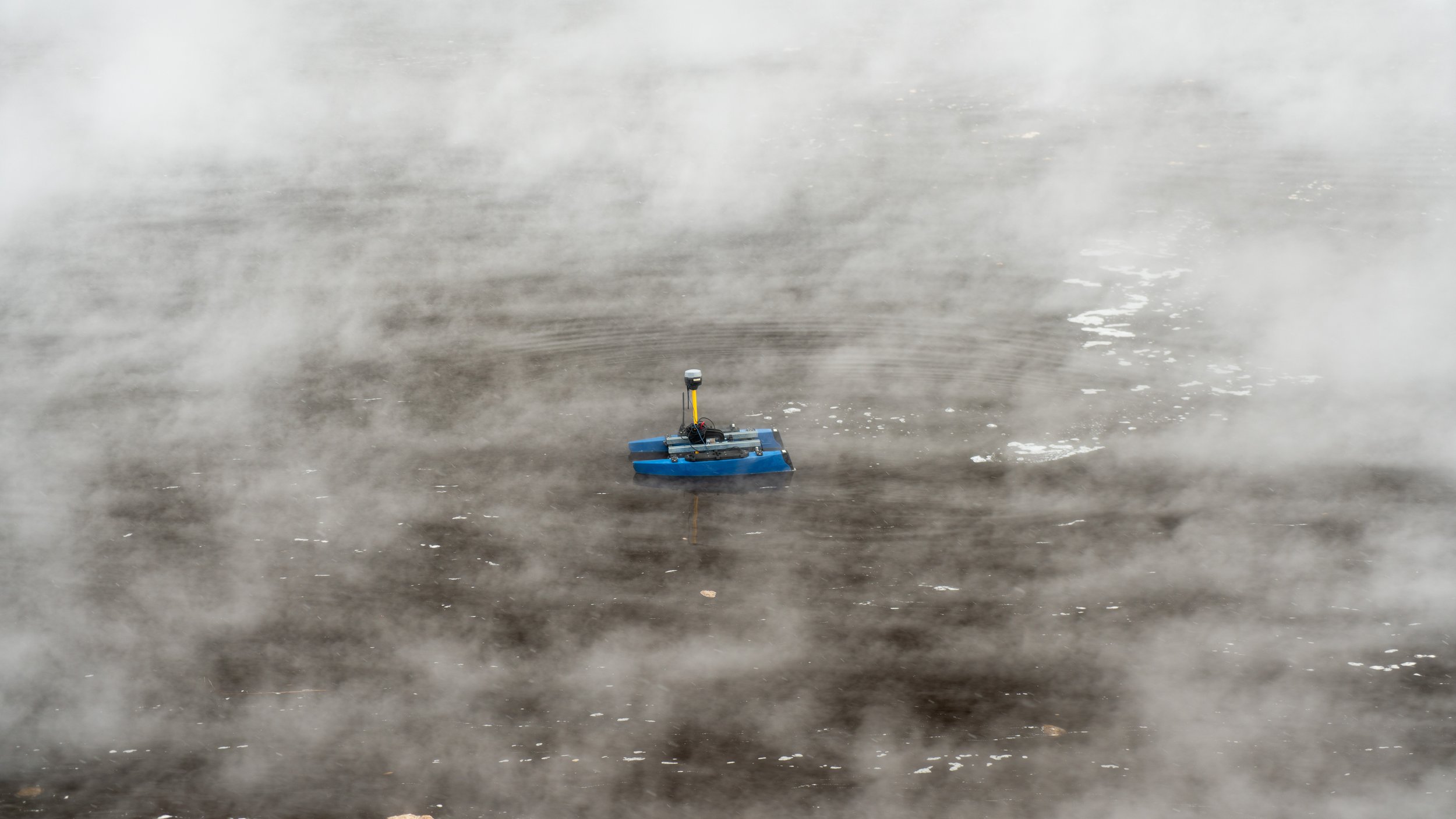
RTK GNSS Positioning
Using RTK GNSS positioning to map your sludge or sediment blanket provides you to the most accurate data.
-
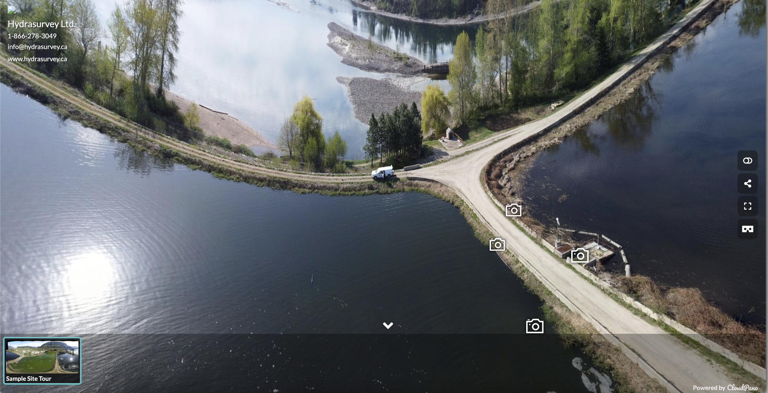
Virtual Site Tour
Our site tours include an aerial map or panoramic photos captured during the survey, with inset images highlighting key findings. This helps identify mechanical or infrastructure issues that might be missed from a single vantage point.
Why Choose Hydrasurvey for your Bathymetric Sludge or Sediment Survey?
-
Without proper sludge measurement, bids from dredging contractors can vary widely.
A bathymetric survey provides exact sludge volumes and maps, ensuring contractors give you a competitive and fair estimate.
-
Knowing how much sludge or sediment is in your lagoon or pond allows for more precise budgeting.
Avoid unexpected costs by scheduling sludge or sediment removal only when needed.
-
Ensure that dredging services meet project goals by comparing before and after sludge levels.
Use data to assess the effectiveness of bioaugmentation treatments.
-
That means our data is:
Unbiased
Accurate
Designed to save you money
Virtual Site Tours
Now included with every Comprehensive Survey Report

Managing a lagoon project remotely? Bidding on a project in a distant town?
Our site tours include an aerial map or panoramic photos captured during the survey, with inset images highlighting key findings. This helps identify mechanical or infrastructure issues that might be missed from a single vantage point. It’s especially valuable for clients with limited site access or those managing projects remotely.
Plus, it’s a great visual aid for group presentations or council meetings.
Check out this Virtual Site Tour as an example of what to expect!
A Virtual Site Tour brings the lagoon to you—right from your office.
Virtual Site Tour from a Wastewater Lagoon Sludge Survey
Frequently Asked Questions
-
Once you have measured and mapped your sludge you can obtain competitive quotes from dredging or bioaugmentation contractors. Without a survey you rely on contractor advice with no way to gauge if the work is necessary or a way to measure their performance.
-
Our sludge surveys provide you with an accurate sludge volume and the treatment capacity of your lagoon, which is a clear indicator of the need to dredge or not.
We can also determine sludge volume in localized areas for spot dredging if you have a limited budget.
-
We determine in-situ sludge or sediment volumes and associated dry tonnage, which wastewater contractors use to estimate costs for desludging or bioaugmentation.
You will have data that levels the playing field for contractors so you will receive the lowest cost to complete the work.
-
We monitor dredge contractor performance and have experience communicating our results with all parties. Our surveys help ensure contractors are able to dredge the entire lagoon.
-
We sample and test the sludge in an accredited lab to identify your disposal or reuse options.
-
We evaluate if your bioaugmentation product is effective by completing surveys at different time intervals then we compare any changes.
-
We calculate the rate of sludge or sediment accumulation, by extrapolating this rate, we determine when your lagoon or pond will be full. This provides you with a timeline for planning future projects.