
Why Mapping the Sediment Blanket Is Critical for Water Infrastructure Management
Stormwater ponds are engineered bodies of water that are designed to hold specific volumes of stormwater runoff. Storm events carry sediment accumulated along roadways or soil runoff from surface erosion into stormwater ponds [1]. Sediment build reduces the overall capacity of stormwater ponds over time. Knowing the sediment amount helps determine the remaining storage capacity and prevent flooding or downstream erosion.
Stormwater ponds also screen pollutants before runoff water is released into local watersheds. Pollutants such as phosphorus, nitrogen, heavy metals, microplastics, and hydrocarbons bind to sediment particles [2]. When a high-velocity storm event happens, the inflows resuspend pollutant-laden sediment particles, leading to the release of pollutants into surrounding watersheds. Periodic sediment removal is essential for maintaining the long-term performance and storage capacity of stormwater ponds.
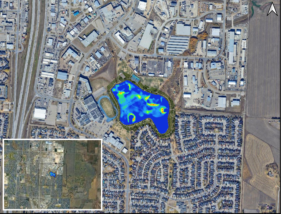
Sediment Distribution Map
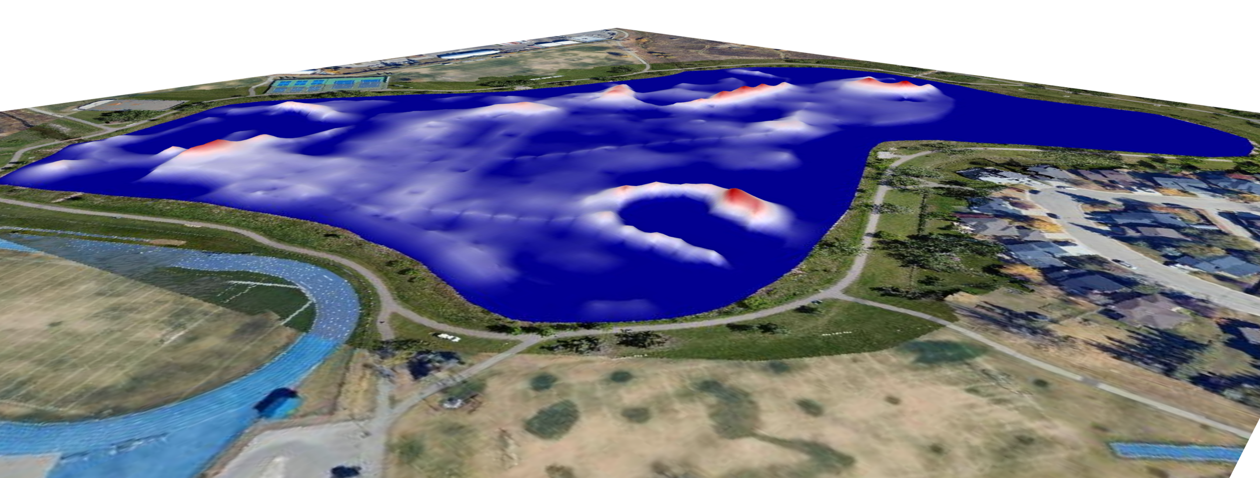
Sediment Thickness Map Used for Dredge Planning
Dredging is often the single largest expense in stormwater asset management. Hydrasurvey sediment surveys can help identify the precise location and volume of sediment accumulation in stormwater ponds. Our sediment distribution maps can reduce the need for full-scale dredging by identifying areas where targeted spot-dredging can be performed.
The Hydrasurvey Method
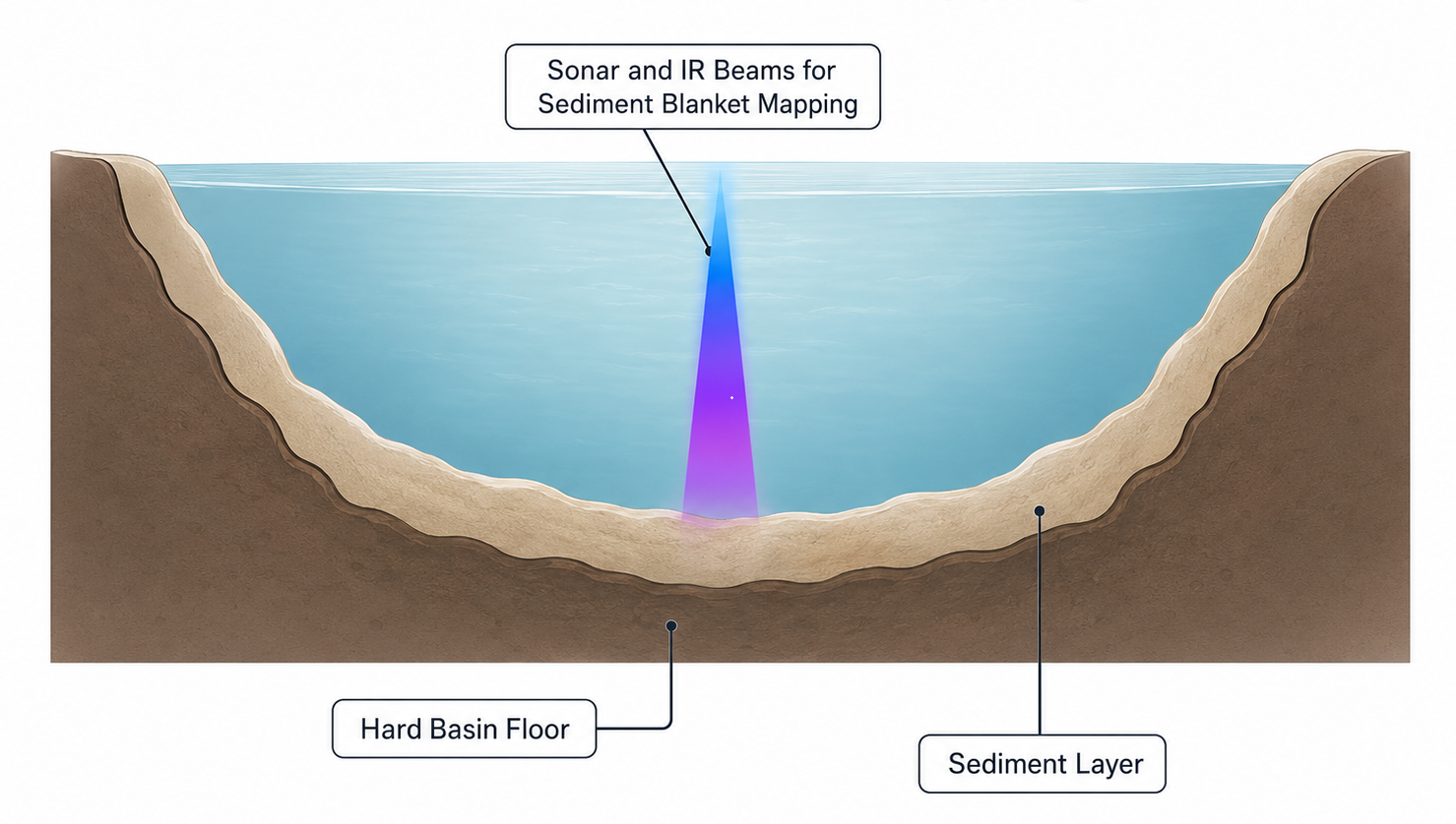
The hydrasurvey methodology for mapping sediment blankets in stormwater ponds is a two step process comprising GNSS-enabled sonar mapping and measurements by infrared (IR) detectors. This ensures our measurements are not affected by subaquatic vegetation that is often present in stormwater ponds as a result of freshwater runoffs.
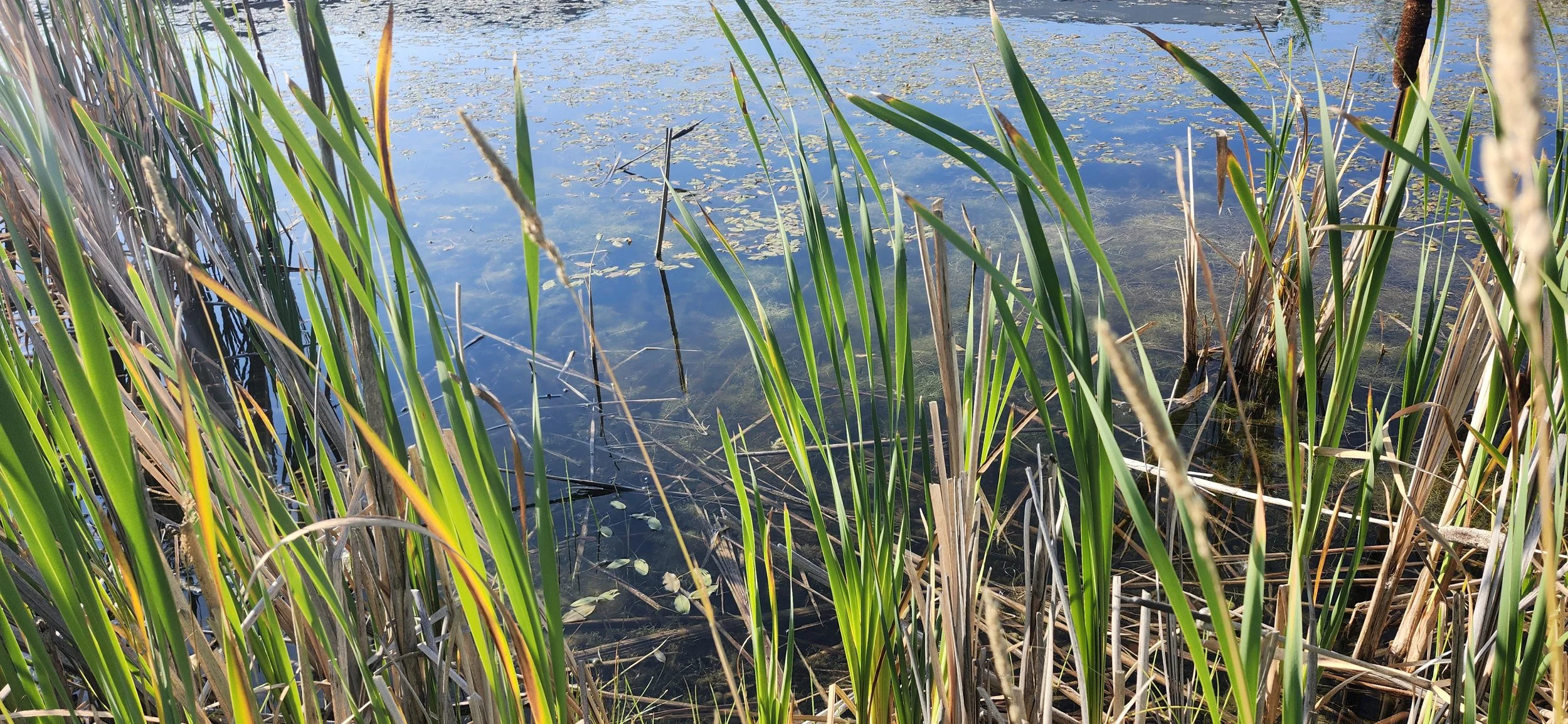
High Vegetation in a Stormwater Pond
Turning Sediment Data Into Better Maintenance Decisions
Once the sediment blanket has been mapped, the data can be used to support practical maintenance and capital planning. Sediment thickness and distribution maps show where accumulation is concentrated, while volume calculations provide a measurable basis for defining the scope of future sediment removal.
This information can help asset managers determine whether dredging is required, identify areas that may be suitable for targeted removal, and provide contractors with clearer quantities before pricing begins. The survey also establishes a baseline that can be compared with future surveys to monitor sediment accumulation over time.
Rather than making dredging decisions based on surface observations or estimates, stormwater pond managers can plan maintenance using measured conditions below the waterline.
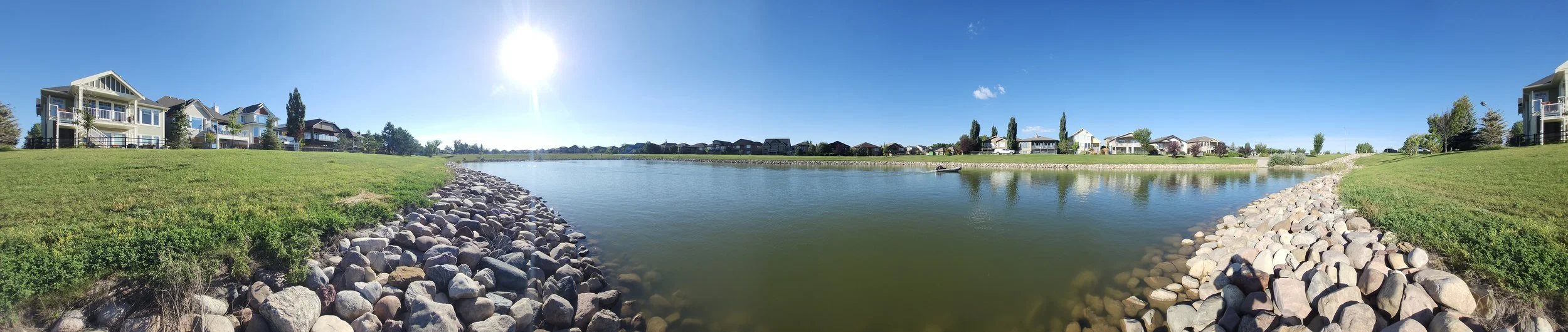
A Well Managed Stormwater Pond
The Takeaway
Sediment buildup is more than a maintenance issue. It directly affects the storage capacity and long-term performance of stormwater ponds.
Mapping the sediment blanket gives asset managers a clear picture of how much sediment has accumulated, where it is concentrated, and how much capacity remains. That information can also help determine whether full-scale dredging is necessary or whether targeted spot dredging could address specific areas of accumulation.
Before you dredge, know what is below the surface. Measure first. Plan second. Act with confidence.
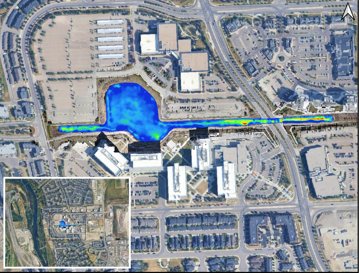
Sediment Map of a Stormwater Pond in an Alberta City
References
[1] Gu, Li, et al. “Sediment Modelling and Design Optimization for Stormwater Ponds.” Canadian Water Resources Journal / Revue Canadienne Des Ressources Hydriques, vol. 42, no. 1, Jan. 2017, pp. 70–87. DOI.org (Crossref), https://doi.org/10.1080/07011784.2016.1210542.
[2] Flanagan, Kelsey, et al. “Contamination of Urban Stormwater Pond Sediments: A Study of 259 Legacy and Contemporary Organic Substances.” Environmental Science & Technology, vol. 55, no. 5, Mar. 2021, pp. 3009–20. DOI.org (Crossref), https://doi.org/10.1021/acs.est.0c07782.